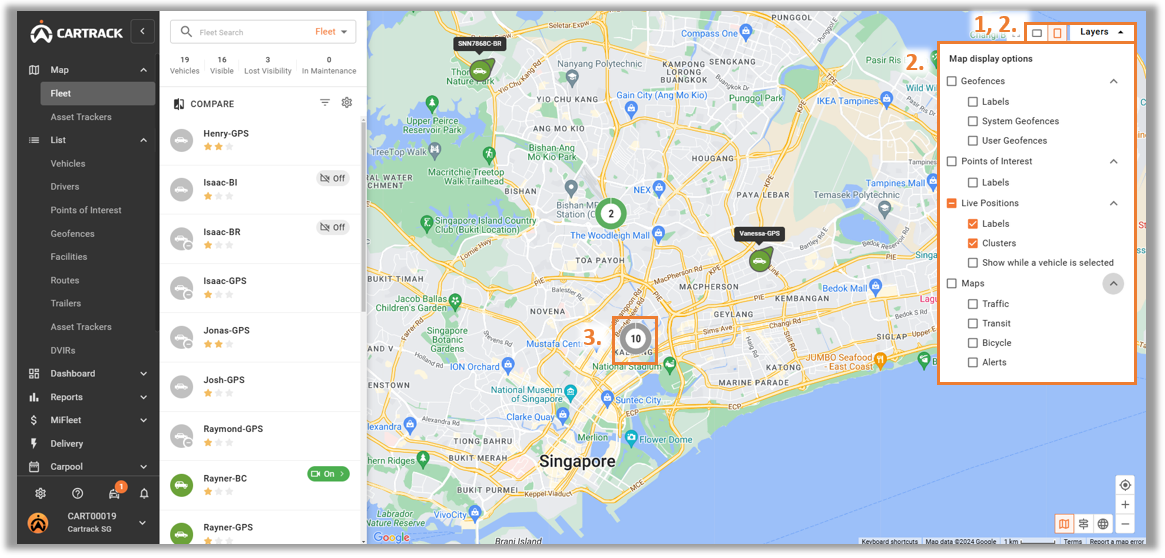
1. Toggle between the landscape and portrait layout. 2. Allow users to turn on different layers on the map. 3. Depicts the number of vehicles in proximity.
Note: Geofence is a user-defined area to monitor vehicle movement. Point of Interest is a point on the map that is of importance to the user.